
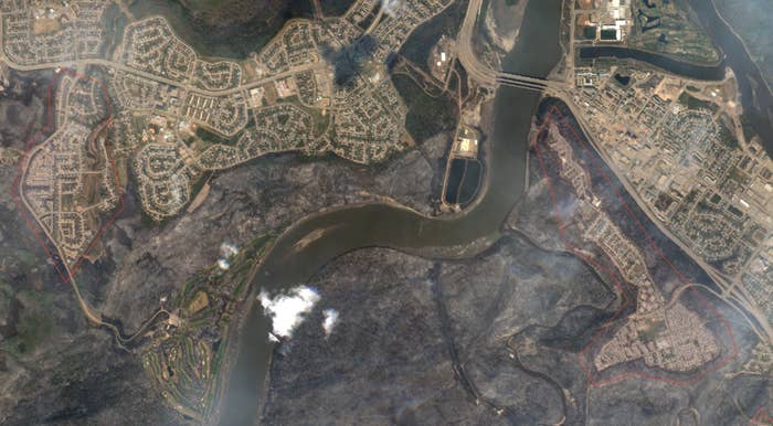
Satellite images of Fort McMurray, taken two days before and after a wildfire swept through the city, show how badly some neighbourhoods were damaged.
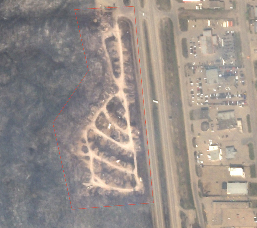
Centennial Trailer Park
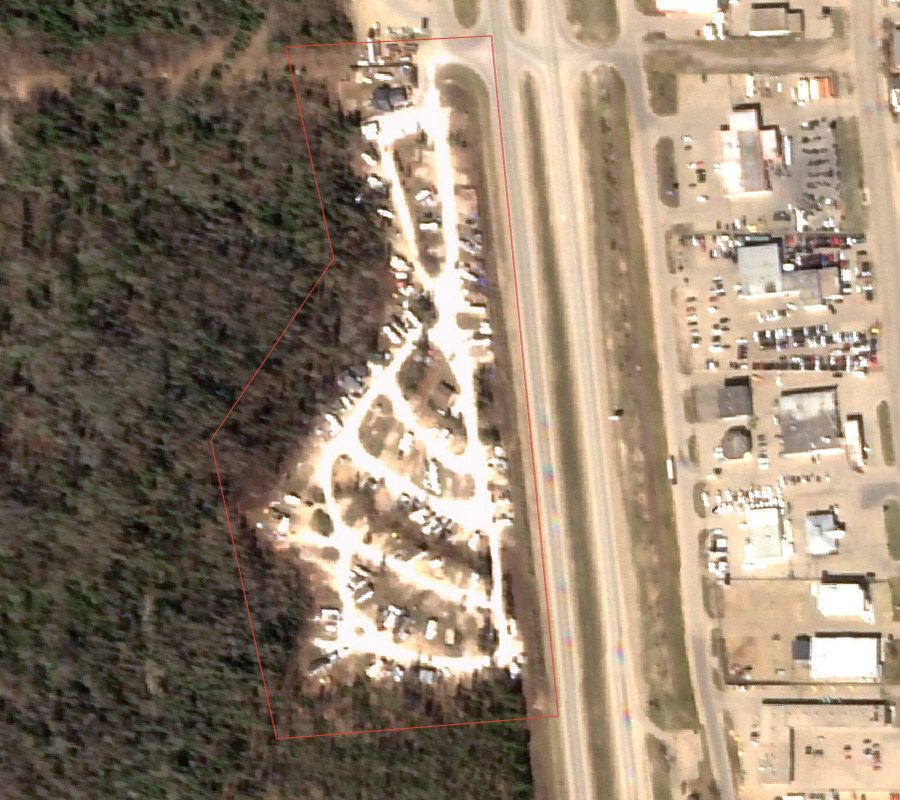
One of the first parts of Fort McMurray to catch fire, the Centennial Trailer Park appears almost completely destroyed, with only the charred remains of the homes left visible.
One of the first parts of Fort McMurray to catch fire, the Centennial Trailer Park appears almost completely destroyed, with only the charred remains of the homes left visible.
One of the first parts of Fort McMurray to catch fire, the Centennial Trailer Park appears almost completely destroyed, with only the charred remains of the homes left visible.
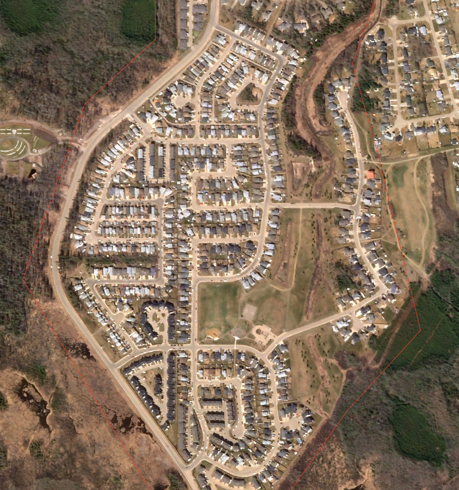
Abasand
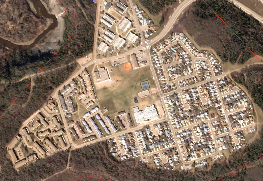
About half the homes in Abasand were destroyed, according to the local government.
Satellite imagery, shot through a layer of smoke, shows how whole blocks were flattened into rubble.

About half the homes in Abasand were destroyed, according to the local government.
Satellite imagery, shot through a layer of smoke, shows how whole blocks were flattened into rubble.
About half the homes in Abasand were destroyed, according to the local government.
Satellite imagery, shot through a layer of smoke, shows how whole blocks were flattened into rubble.
Beacon Hill
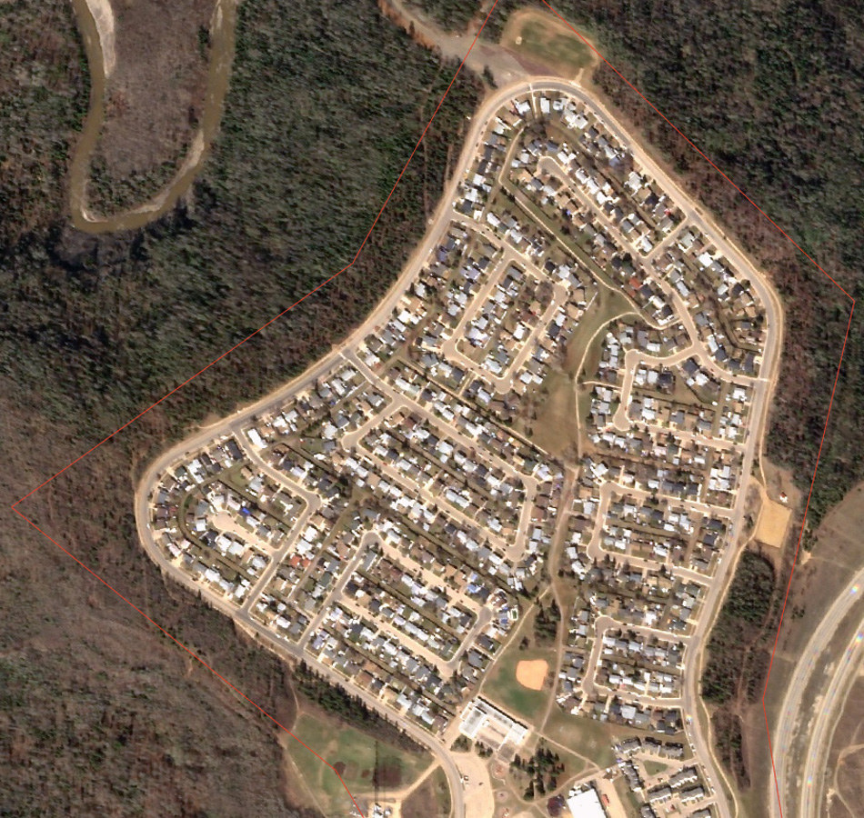
Beacon Hill was one of the hardest hit neighbourhoods, with more than two thirds of homes lost to the fire. Some residents managed to escape with only minutes to spare.
Beacon Hill was one of the hardest hit neighbourhoods, with more than two thirds of homes lost to the fire. Some residents managed to escape with only minutes to spare.
Beacon Hill was one of the hardest hit neighbourhoods, with more than two thirds of homes lost to the fire. Some residents managed to escape with only minutes to spare.
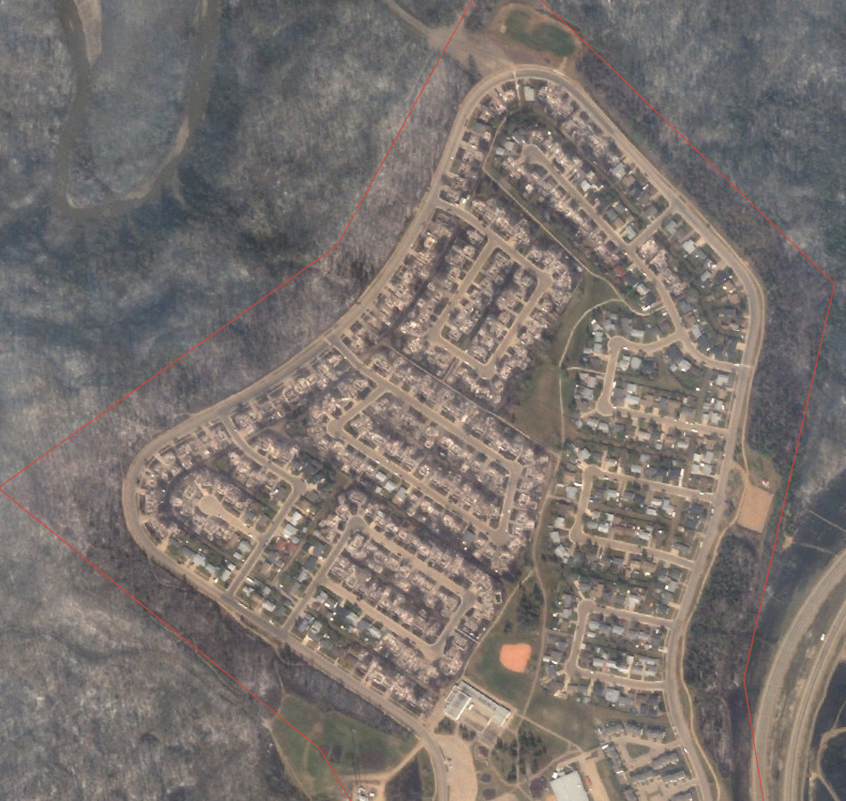
Wood Buffalo
More than 30 homes were destroyed in Wood Buffalo, seen here on the left side of the image.

More than 30 homes were destroyed in Wood Buffalo, seen here on the left side of the image.
More than 30 homes were destroyed in Wood Buffalo, seen here on the left side of the image.
Waterways
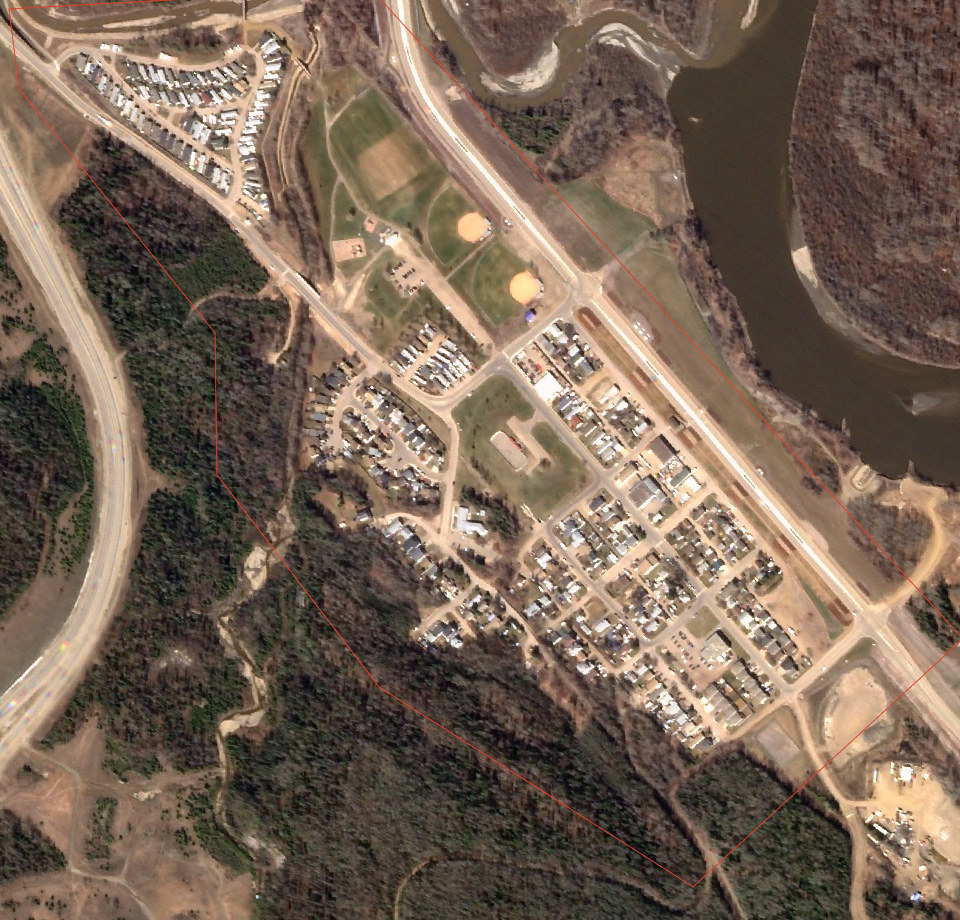
According to local authorities, 90% of homes in Waterways were lost to the flames.

According to local authorities, 90% of homes in Waterways were lost to the flames.
According to local authorities, 90% of homes in Waterways were lost to the flames.