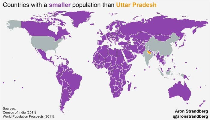
1.In case you didn't think India is a little too crowded, these are all the countries where you'll find fewer humans than are currently living just in Uttar Pradesh.
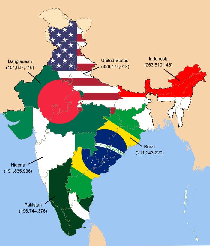
2.Meanwhile, this rough map illustrates that the population of India is as high as the next six most populated countries of the world... combined.
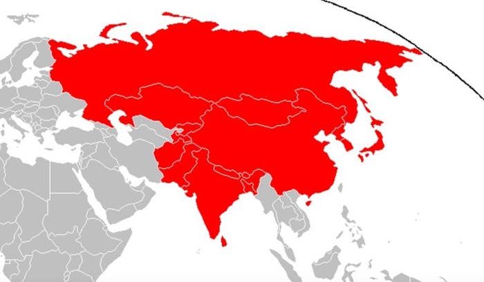
3.And then there's this one, which depicts how much area India would cover if its population density was the same as the United States.
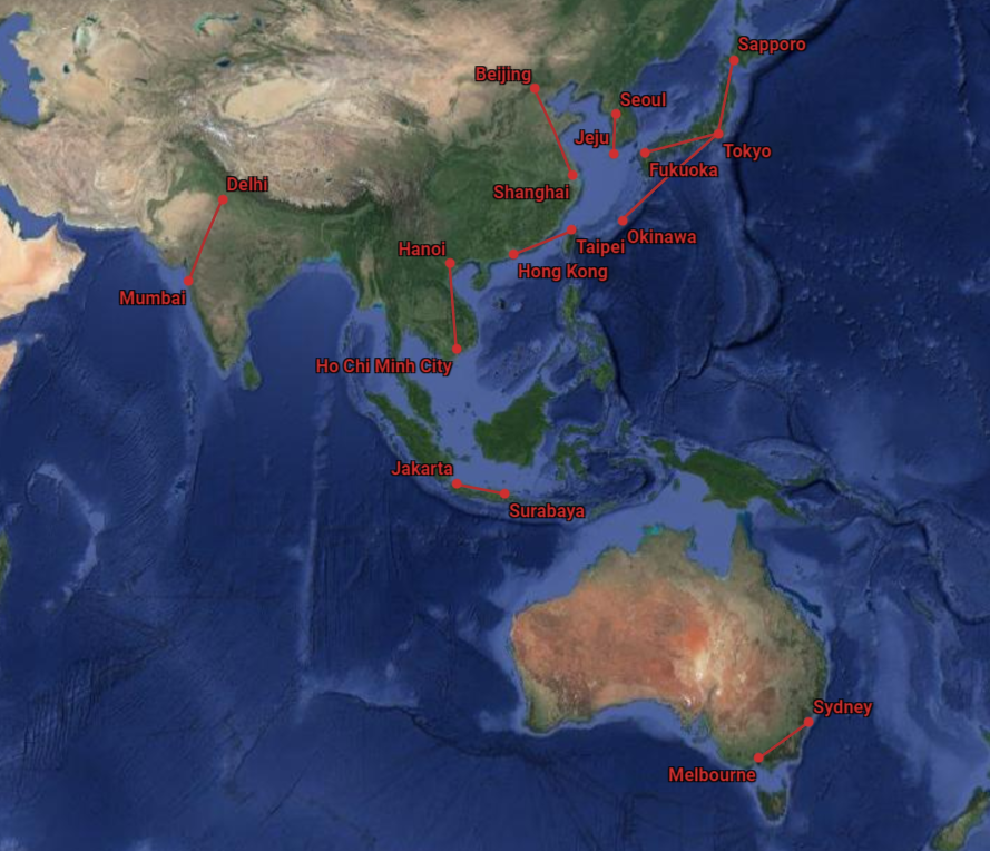
4.These are the 10 busiest airline routes in the world by seat capacity and, unsurprisingly, Delhi-Mumbai is one of them.
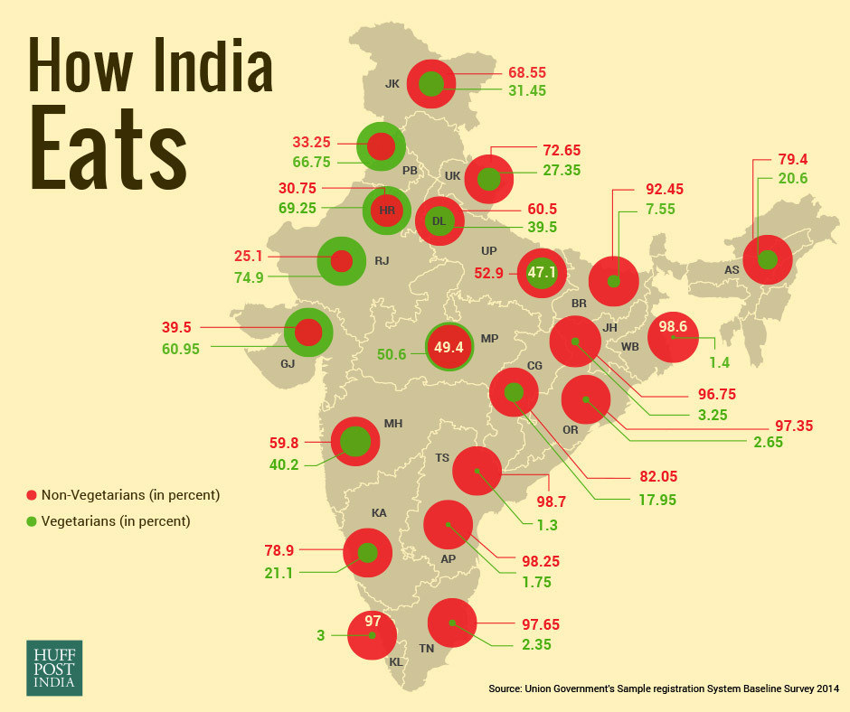
5.This map shows that there are way more non-vegetarians in India than you'd think.
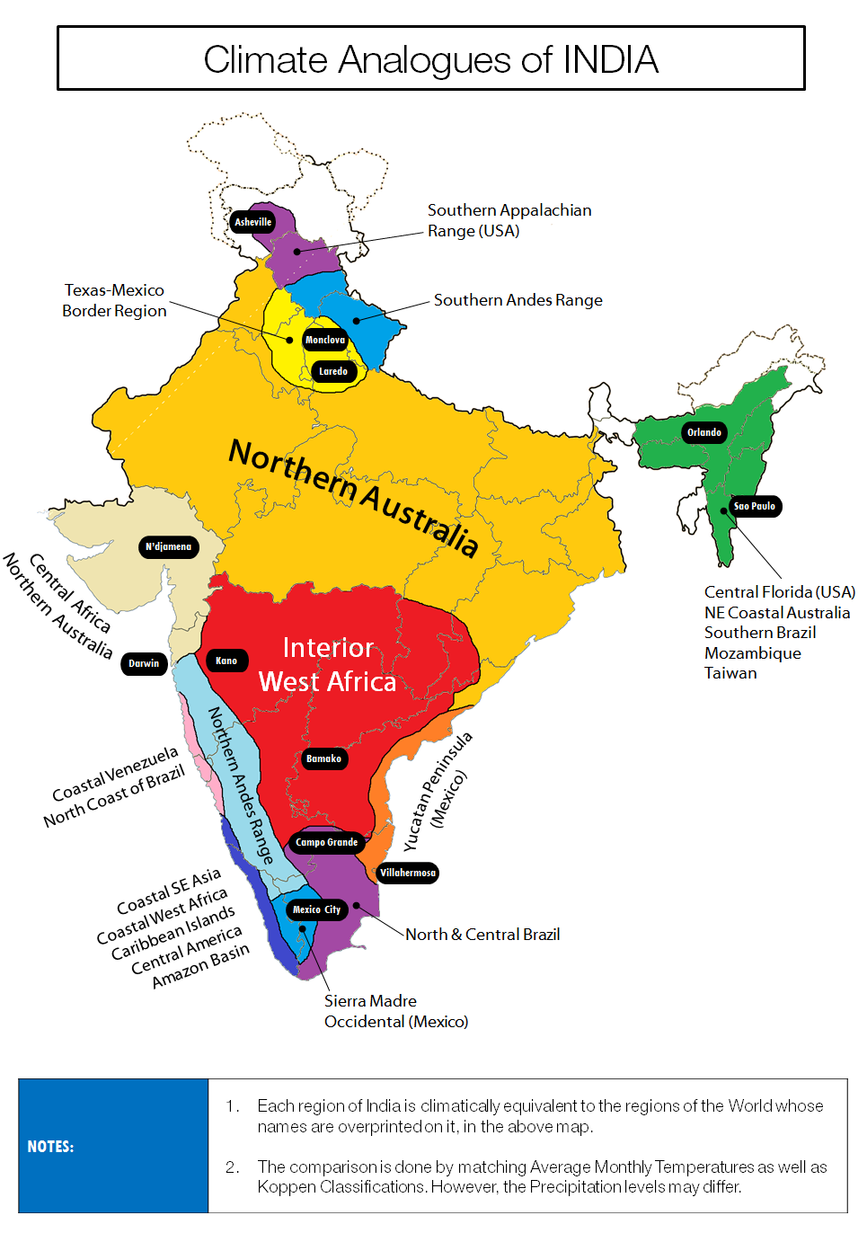
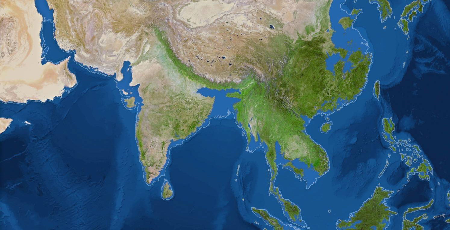
6.This map depicts climate patterns around India, and which parts of the world they most resemble.
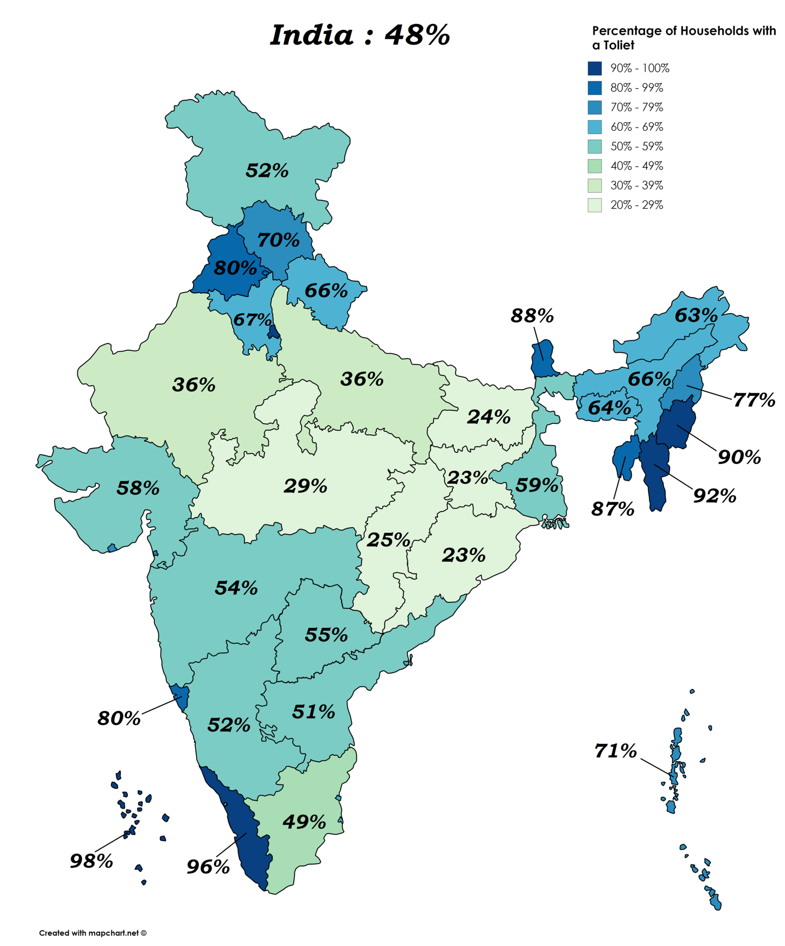
7.This eye-opening map, illustrating the percentage of Indian households with a toilet, shows why providing basic sanitation is such a priority for the government.
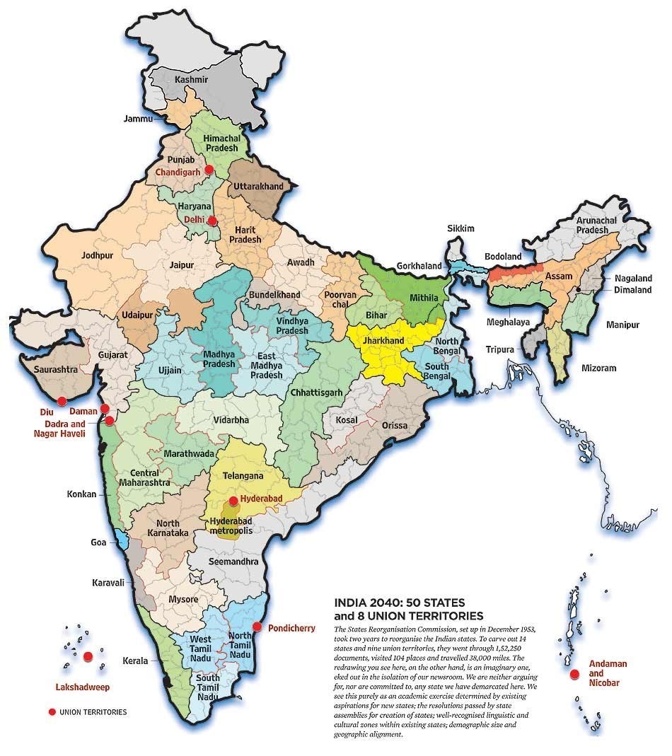
8.This map hypothesises what Indian state divisions might look like in 2040, going by historical and demographic trends.
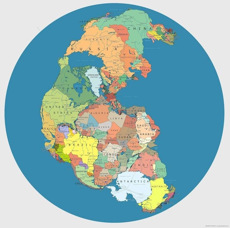
9.This map shows us that India would neighbour Antarctica if Pangaea existed with modern global borders.
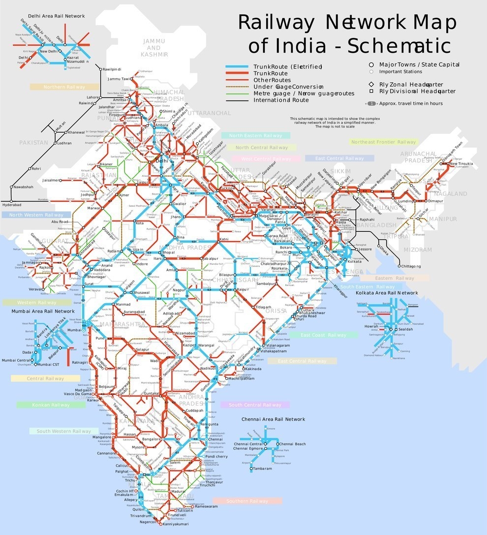
10.This detailed map shows the intricate railway network that ties India together.
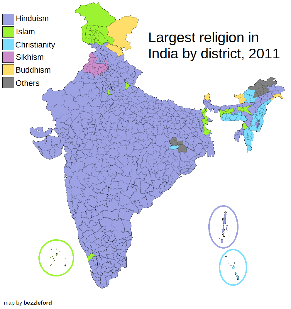
11.This map is based on the 2011 census, and shows the most prevalent religion in each Indian district.
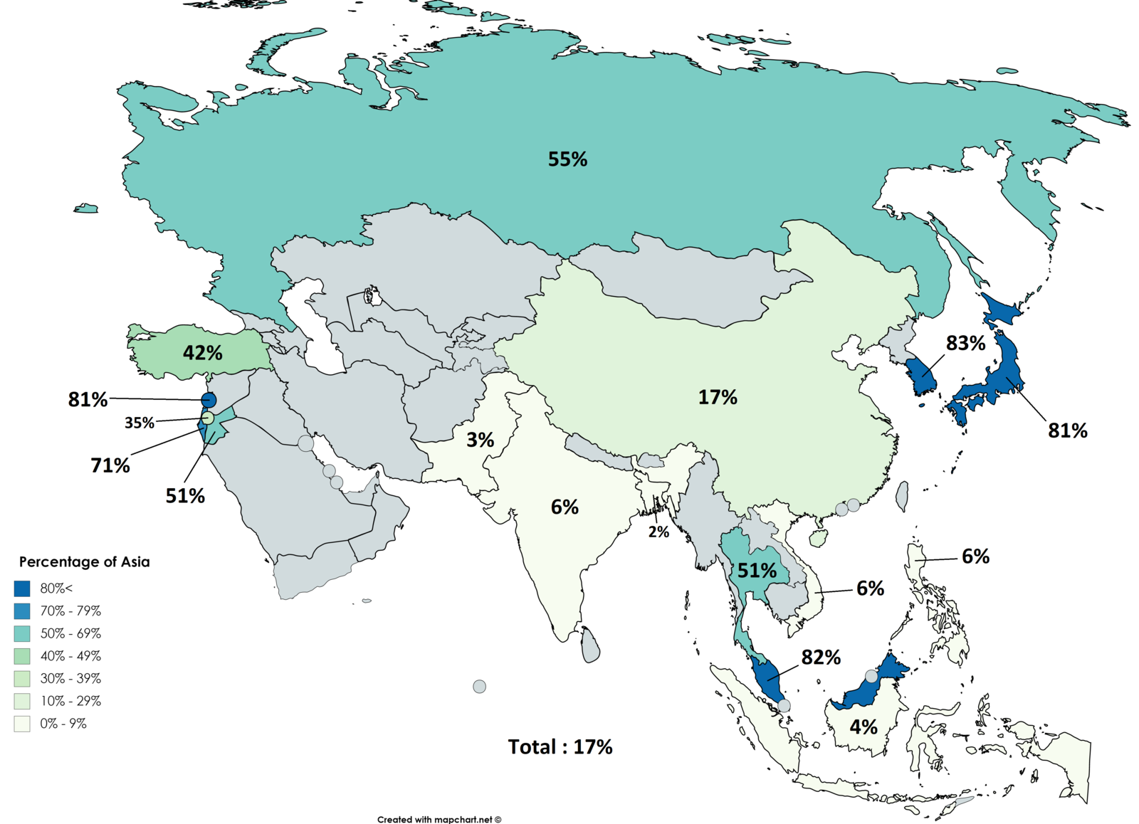
12.This is how India compares to the rest of Asia when it comes to the percentage of households that own cars.
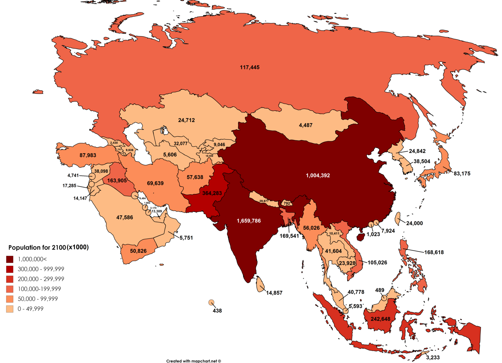
13.This scary map depicts the population of Asian countries by the year 2100.
14.This is what would be left of India if all the ice in the world melted.
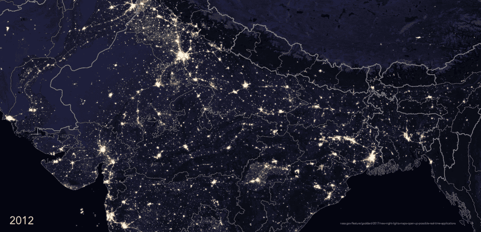
15.And this (legit) map from NASA depicts what India looks like from space at night, and the progress shown in the electrification of villages between 2012 and 2016.
