

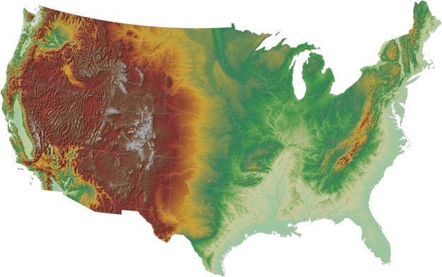
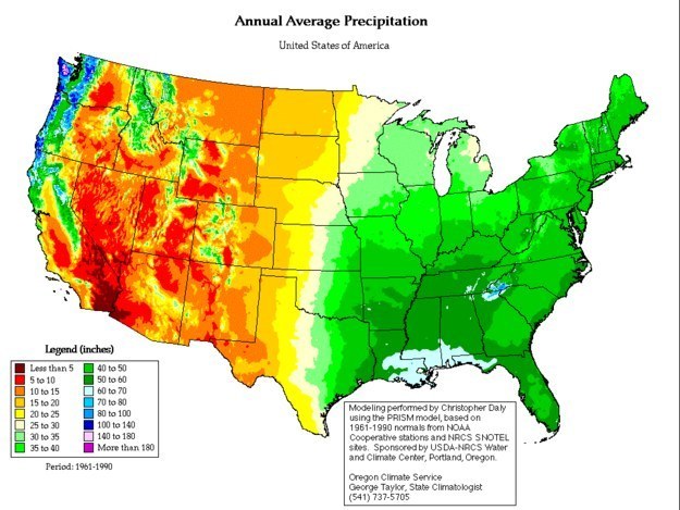
1. You've read National Geographic, you know the USA has a bunch of different climatic zones, but WOW, check this glorious topographic map!
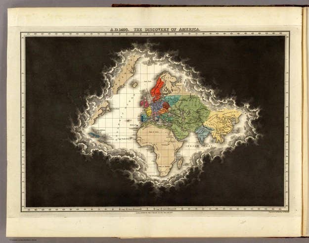
2. And here's what the mapped world looked like in 1498, just after the 1492 "discovery" of the Americas.
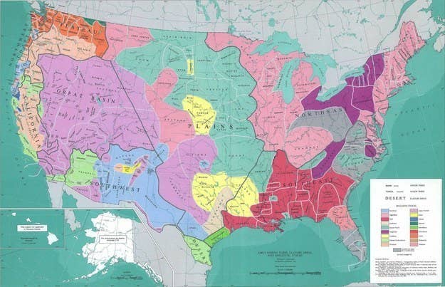
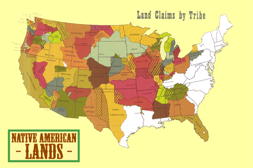
3. Of course, in 1492 the lands that would eventually become the United States were already a rainbow nation of Native American peoples.
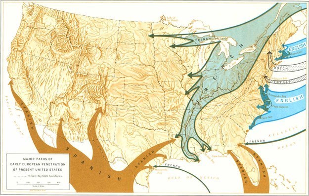
4. And then, the European "penetration" began.
5. So that eventually...


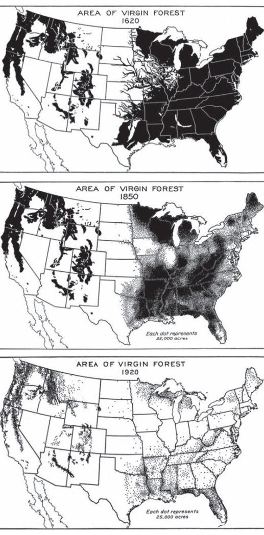
6. Meanwhile, here's what happened to old growth forests.

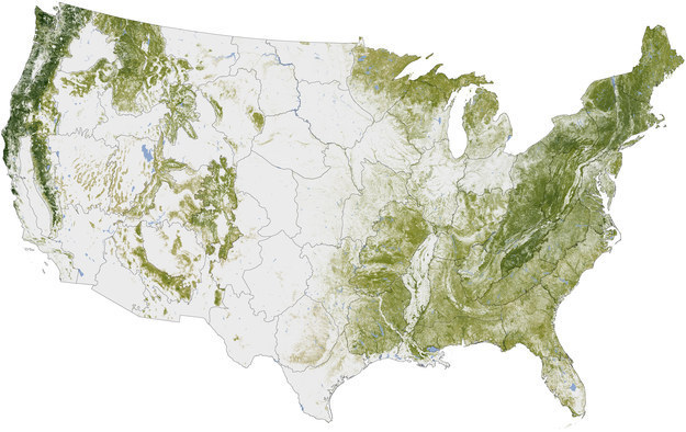
7. Thankfully, today the U.S is still home to a whole bunch of trees.
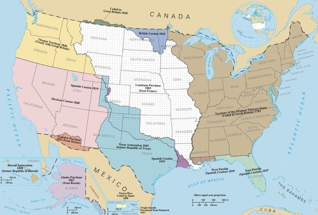
8. So how were the states united? Well, not at the same time, and mostly by acquisition or conquest.
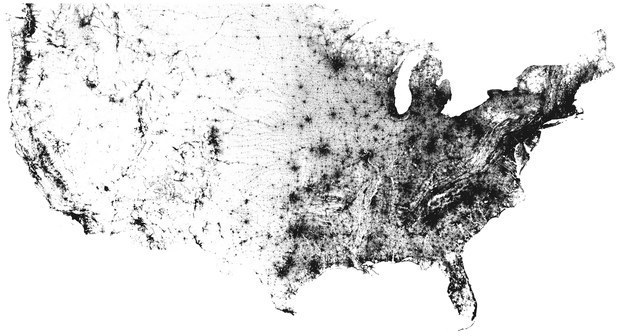
9. So where does everyone live today? Here's the contiguous* United States, with one dot per person.
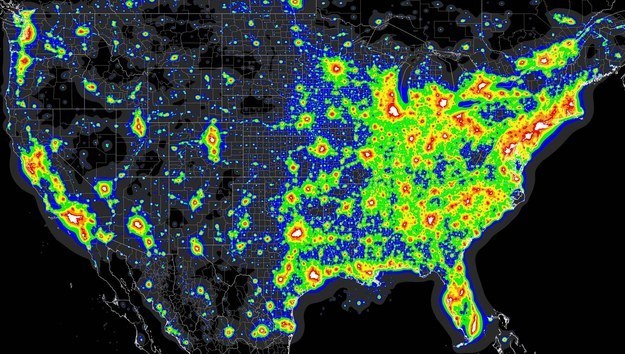
10. Or alternatively, via light pollution...
11. Why are there are loads of people until the midwest, and then nada? Because the Wild West is too dry to support a big population.
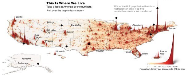
12. Here's population density represented as spikes.
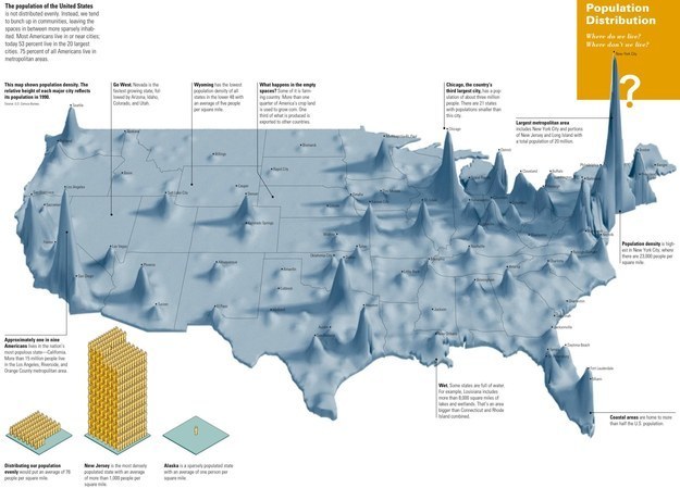
(Similar infographic, with 2000 data from U.S. Census Bureau.)
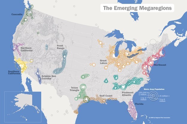
13. Increasingly, Americans are living in what researchers have dubbed "megaregions", interlinked population centres already home to 78% of the USA's 318m citizens.
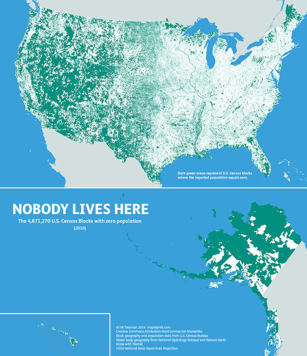
14. 318 million people? So the U.S. is pretty densely populated then? Nope. This map shows census blocks with ZERO population: turns out 47 percent of the USA remains unoccupied.
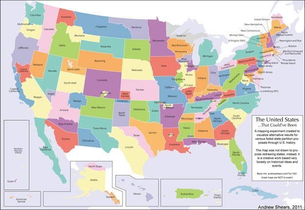
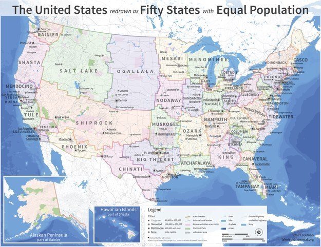
15. Today, the U.S. is made up of 50 states and the federal district of Washington D.C. Complicated right? But imagine if every failed state partition proposal had actually come to pass. The USA would look like this...
16. Maybe the U.S. would be easier to understand if state size was scaled by population?
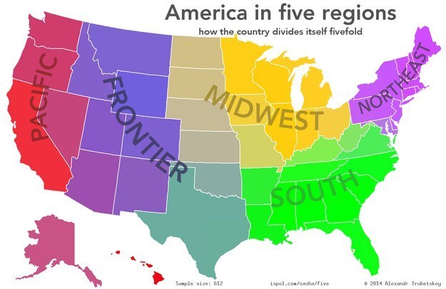
17. Or if the whole nation was just divided into five regions?
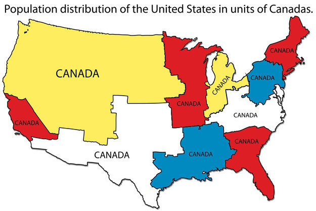
18. Or made really easy to understand for those north of the 49th parallel?
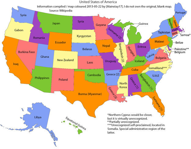
19. So far so BIG right? What if the U.S. states were renamed as countries with a similar total area?
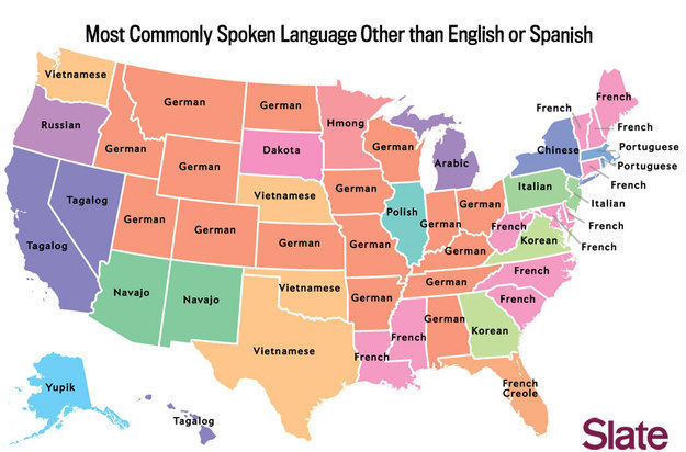
20. Minus English and Spanish...
21. Minus all the pre-conquest languages.
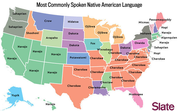
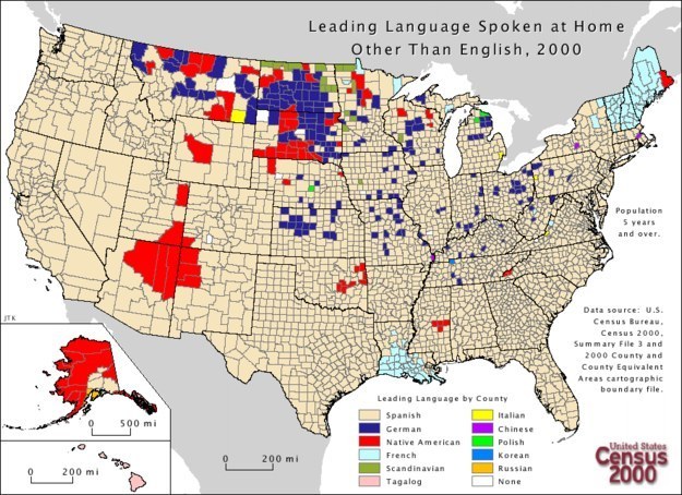
22. That would mean a lot of different languages. So no change there. Here are the most frequently spoken languages after English.
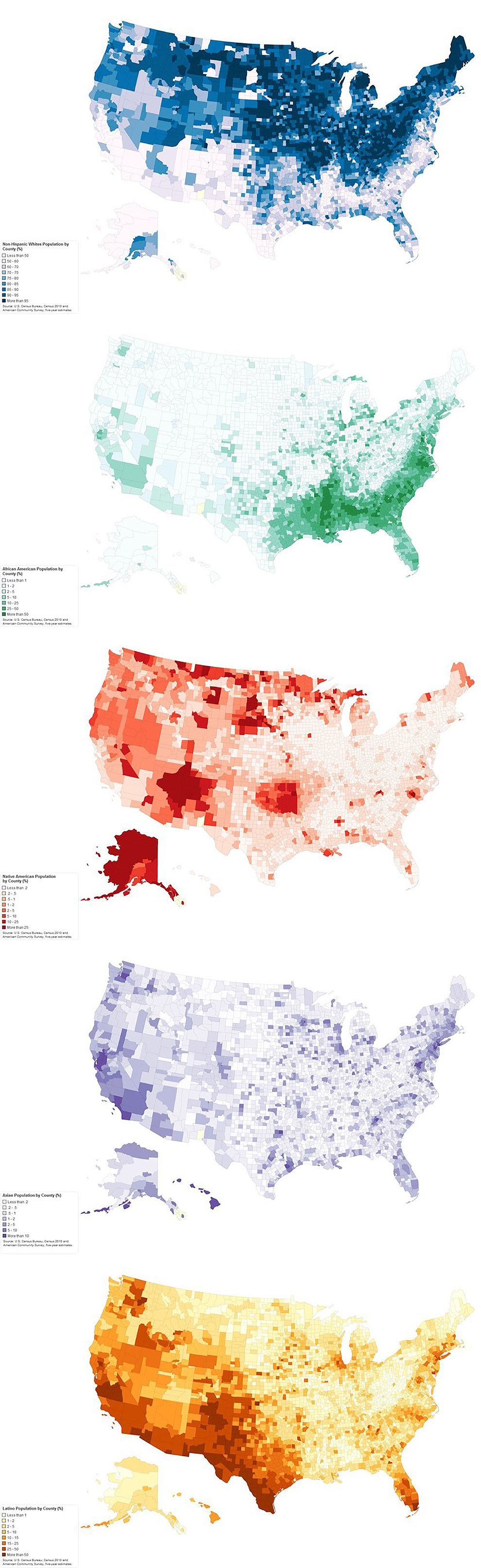
23. This might be a good time to check out the USA's population distributed by ethnicity.
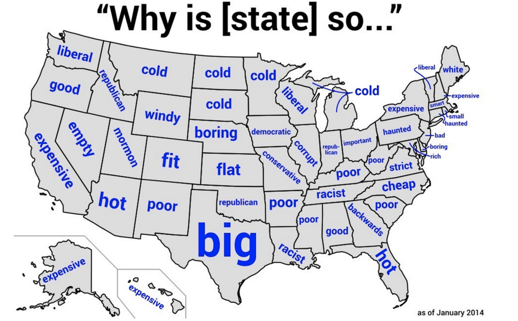
24. Ever wondered what America thinks of itself? Google autocomplete knows...
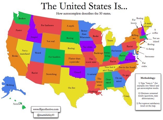
25. Or alternatively, via Yahoo...
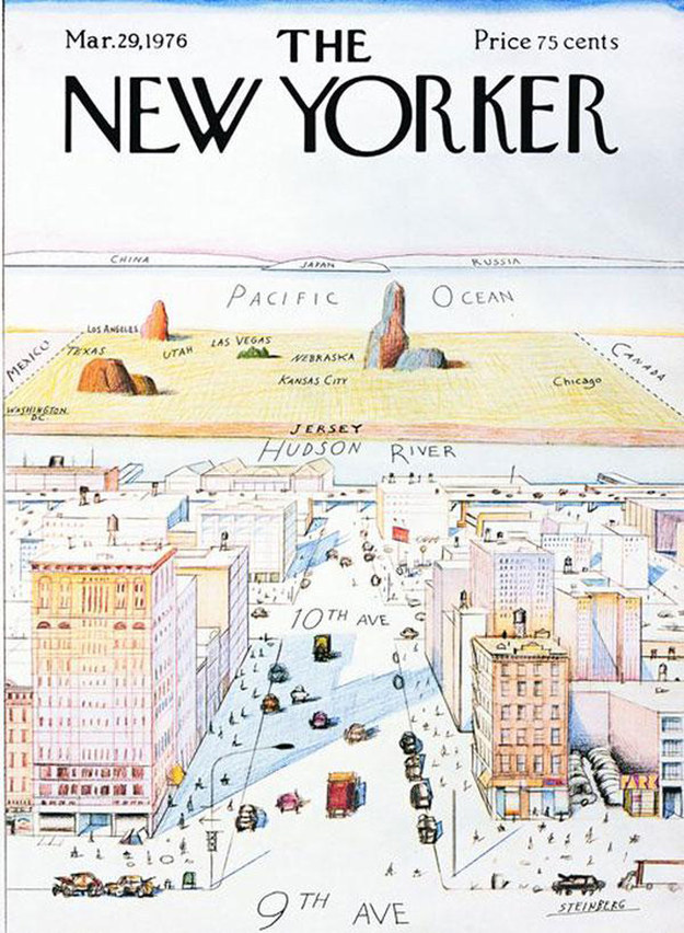
26. How the U.S. looks from New York City.
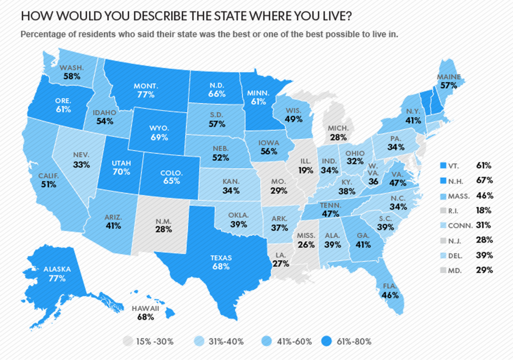
27. New Yorkers are certainly proud of their city, but plenty other Americans are prouder of their own state.
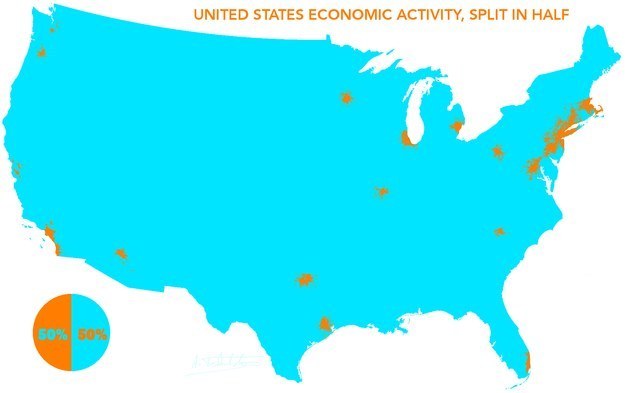
28. So where's the money?
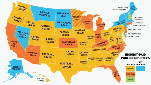
29. The U.S. is sports mad. So you're probably not surprised by this map of states' highest-paid public employees?
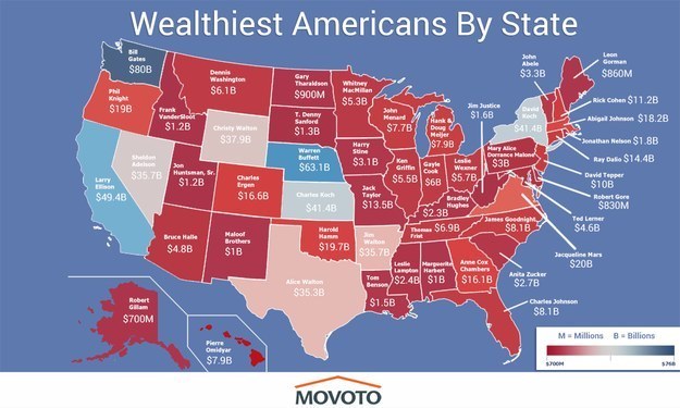
30. Talking of money, here's a bunch of billionaires you may have heard of...
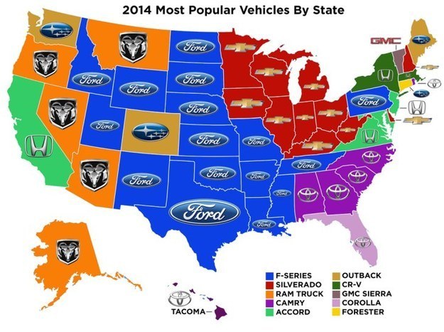
31. And here's what those billionaires are almost certainly NOT driving.
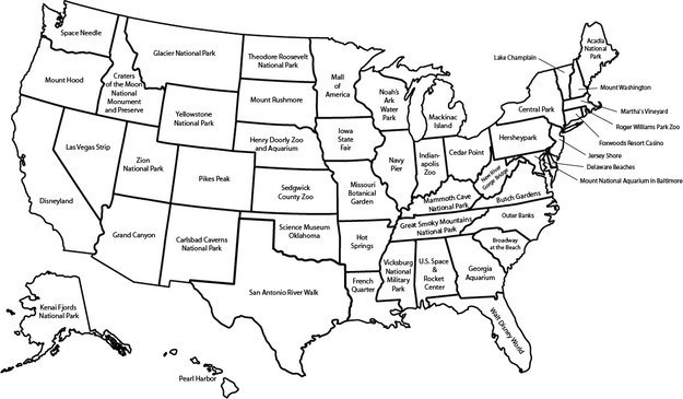
32. Going on a road-trip? Here are the major attractions in each state according to Wikipedia.
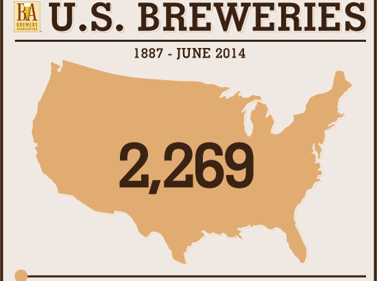
33. All that sightseeing is thirsty work. Thankfully, you're in the right place.
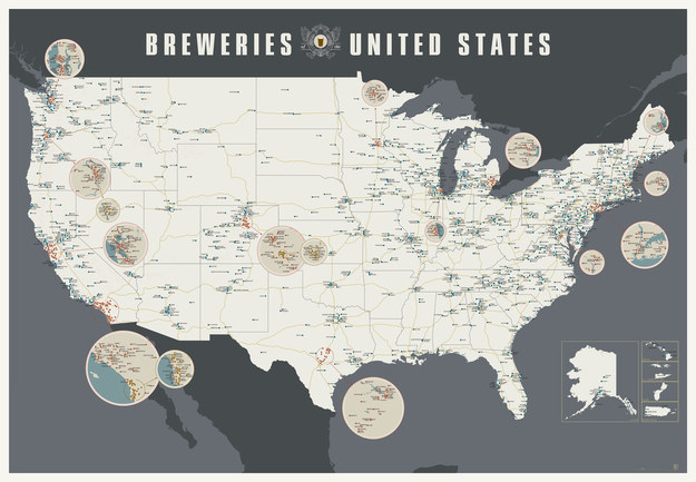
According to the Brewers Association, there are 3,000+ breweries in the U.S.


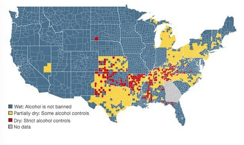
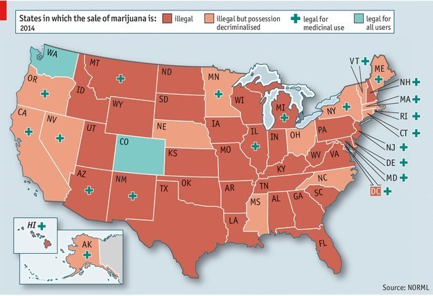
34. Just stay away from the Dry Counties in red on this map.
35. Or maybe you're after a different kind of high.
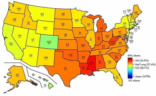
36. Watch you don't get the munchies. As you've probably heard, the USA is one of the most obese nations on Earth.
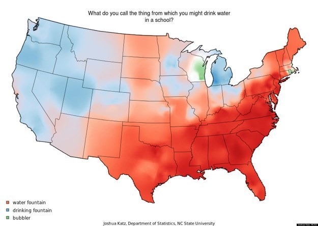
37. Stick to H20. Here's what Americans call "the thing you drink water from at school?"
38. And given we're back on geography, what about the Parting of the Waters in Wyoming? "The river connecting two oceans."
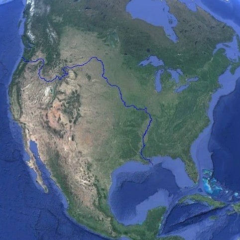
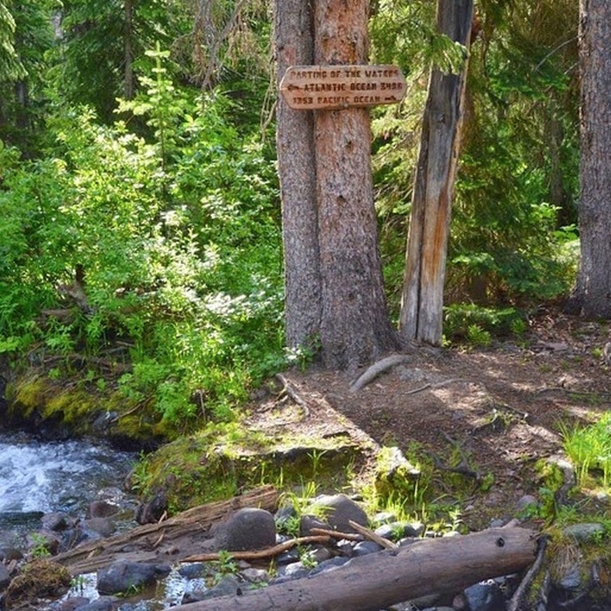
From here Pacific Creek flows westerly 2,177km to the Pacific Ocean, while Atlantic Creek flows 5,613km to the Atlantic Ocean (via the Yellowstone, Missouri and Mississippi Rivers). Source: Amusing Planet.
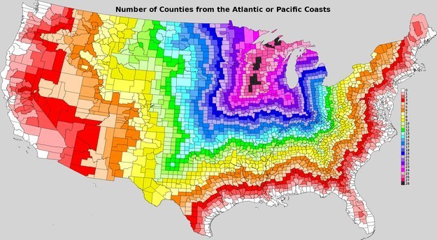
39. Long way right? Some places in the U.S. are a helluva long way from the ocean.
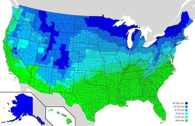
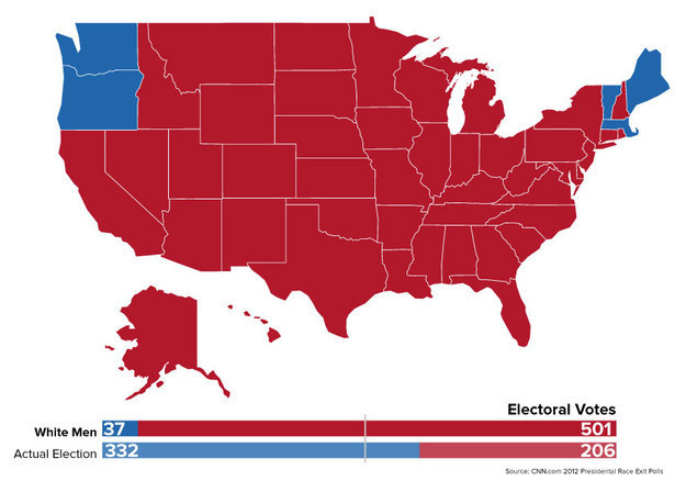
40. Goddamn it, infographics sure are pretty. Here's how much snow it takes to cancel school in the U.S.
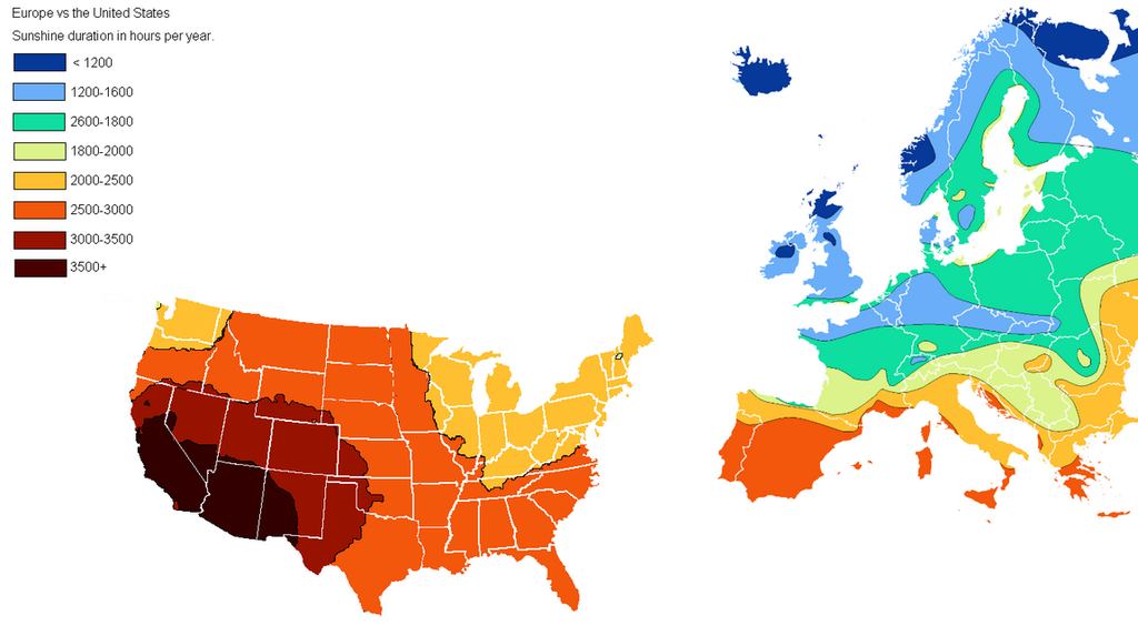
41. Just don't ever let anyone tell you that Europe gets better weather than the U.S.
42. So, how much do you know about U.S. politics? President Obama won in 2012 right? But what would have happened if only white men could vote?
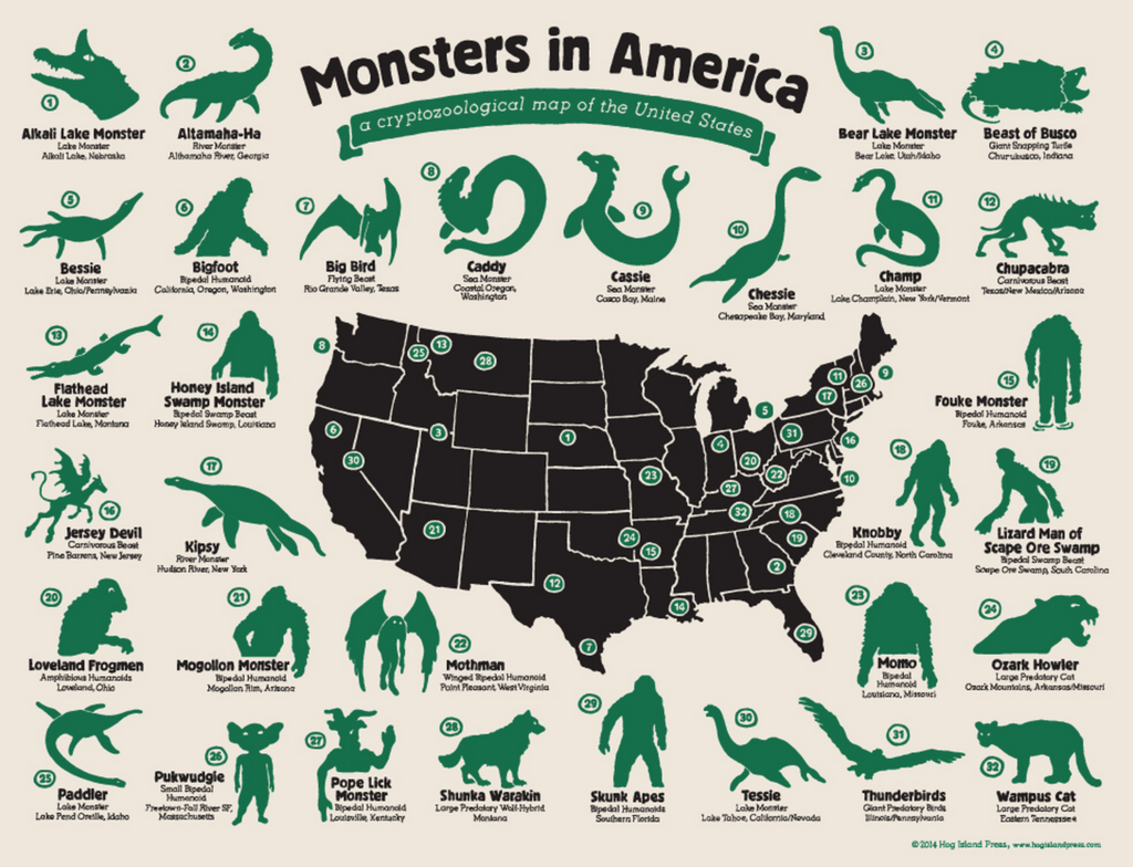
43. Of course the U.S. is packed with monsters.
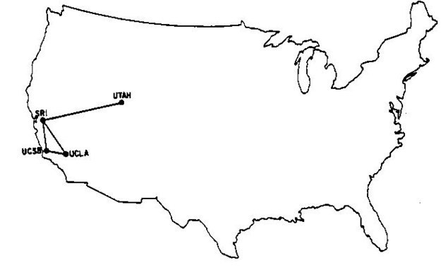
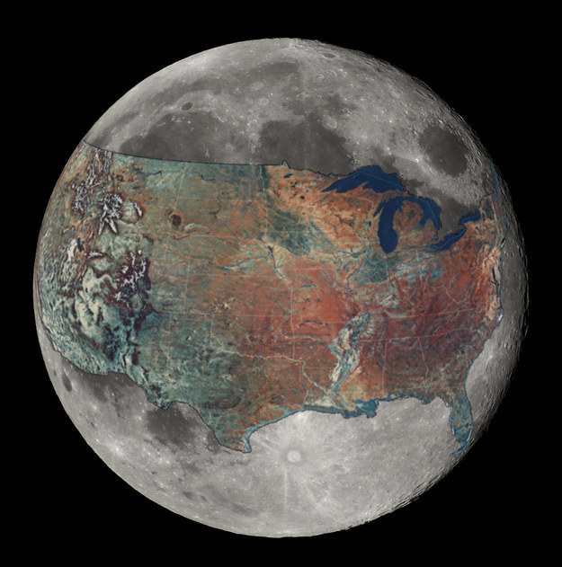
44. Here's a weird, old-school one. The entire internet in December 1969.
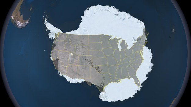
45. PS: in case you were wondering, here's the U.S. compared to Antarctica.
46. Even cooler? The USA overlaid on the Moon, to scale.
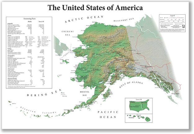
47. Oops, here we are getting all excited about Antarctica and the Moon and we almost forgot about Alaska. So here's how the USA looks if you're Alaskan.
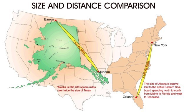
48. And here's Alaska overlaid on the contiguous U.S.
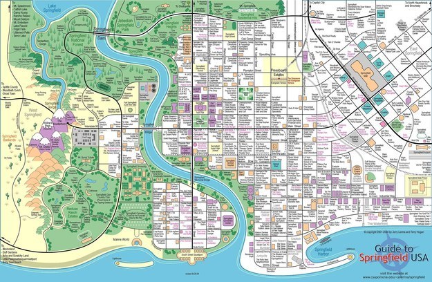
49. Last but most certainly not least: the most important town plan in the U.S. Know Springfield, know America.