
An estimated 13,000 people have been ordered to evacuate their homes due to wildfires raging in Saskatchewan, according to the Red Cross. It's the largest evacuation in the province's history.

A fire rages near the airport in La Ronge.
"This particular fire event is different for our province just because of the amount of hectares that are currently burning, which is, by the way, about 10 times the average year," Premier Brad Wall said on Monday.
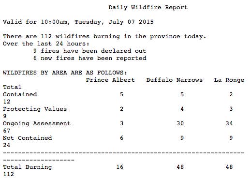
The latest wildfire report issued today by the Ministry of Environment lists 112 active fires in the province, 24 of which are "Not Contained." This means they are expected to grow in size.
The province has called in the Canadian Forces to help fight the fires. An inital team of 500 soldiers is being deployed, and another 900 are ready to be added as needed.

IRU de FOI (Ouest) arrête pour faire le plein à North Battleford, en route vers Prince Albert pour #OpLENTUS
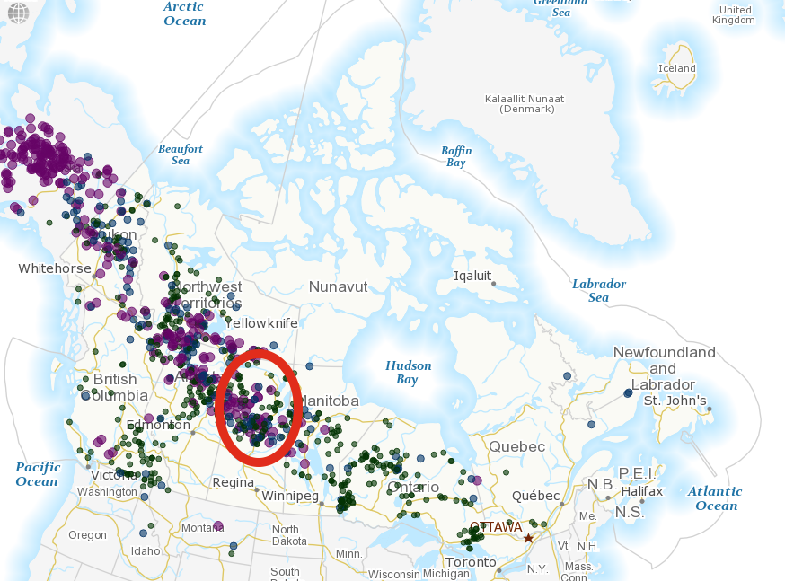
This map from the Canadian Wildland Fire Information System shows the current active fires burning in Canada. There is a large cluster of fires in Saskatchewan. Alberta and B.C. are also seeing a lot of activity.
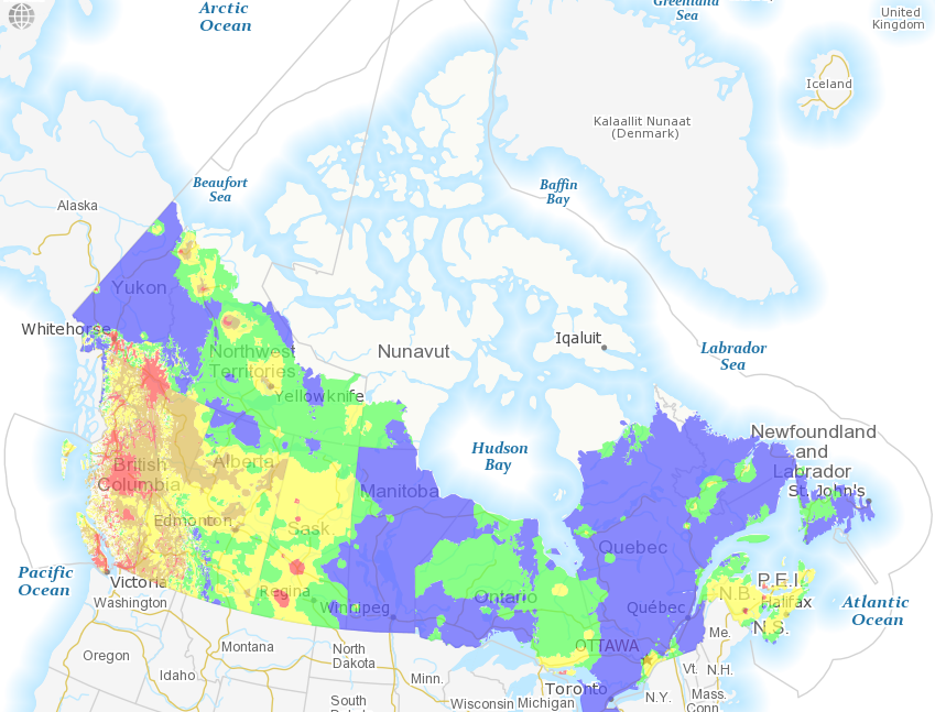
This is a map of wildfire risk in Canada. The dark yellow (Very High) and red (Extreme) sections are the highest risk areas, and Saskatchewan has two very large red areas, among others.
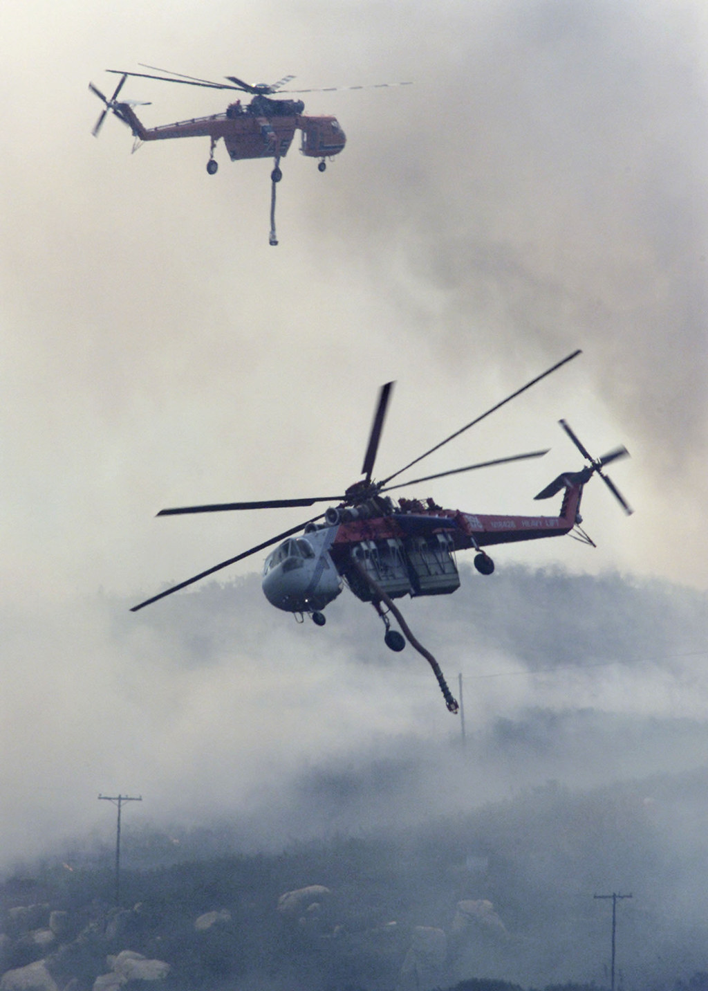
Along with fire crews and the army, water bombers are hard at work in Saskatchewan.
The province has also brought in a Sikorsky S-64 Skycrane helicopter. It can carry approximately 2,400 gallons of water and takes 60 seconds to be refilled.
Crews on the ground continue to battle intense fires.
One firefighter told a CBC journalist that the heat of one fire was so intense that it melted the soles of a firefighter's boots.

Lt. Siemens just told @LeishaCBC he saw a fellow fire fighter walking in his socks b/c the heat had melted the soles of his boots.

Wow. This is what firefighting on front line looks like. Sent in by Caron Dubnick at English Bay, Sask. #skfire
An area in Saskatchewan under threat of wildfire is called La Ronge. This post originally misspelled it as La Range. Also, the map showing wildfire risk was incorrectly labeled as a map showing fire intensity.