
What We Know So Far
• A storm moving in from the southwest is expected to hit the East Coast beginning Wednesday night. • The storm will drop between five and 10 inches of snow on the Baltimore and Washington, D.C., area before clearing out by Thursday night. • New York City could see around six inches of snow. • The storm already was dropping snow on parts of the Midwest early Wednesday evening.
Updates
The storm prompted officials to cancel school in Washington, D.C., Baltimore, and other cities across the East Coast, the South, and the Midwest.

DCPS will be CLOSED, Thurs. March 5, for all students and non-essential school-based staff. Central office should follow the DC GOV decision

FWISD cancels classes for Thursday, March 5, 2015. Details at http://t.co/MpUcYg26qZ

Due to weather conditions, all schools and offices are CLOSED on March 5. PARCC tests will be rescheduled. Please RT.

OFFICIAL: All Metro Schools will be closed tomorrow, Thursday, March 5, in anticipation of the winter weather.

OKCPS has cancelled all classes for Thursday, March 5th due to inclement weather.

All Fairfax County public schools and offices will be closed tomorrow, March 5, 2015. More at http://t.co/zNBBMjWGwr.

@TulsaSchools SCHOOLS ARE CLOSED Thu, Mar 5. The ESC opens at 10 am. All evening events are canceled. Details at http://t.co/6E9jn6zb4G
People in the storm's path shared pictures of what it conditions looked like Wednesday. In Reston, Virginia, there was no more bread at Trader Joes:

shelves at #TraderJoes in #Reston are bare! I hope this means everyone is ready for the snow @capitalweather
In Oklahoma people shared photos of snowy roads:

Pauls Valley! @NEWS9 #NEWS9

In Plano, Texas, roads were covered in ice:

Ice is already covering the ground in #Plano after heavy sleet that's made driving difficult. Be careful! #CBS11wx
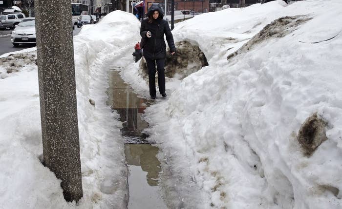
Another major winter storm should slam into the East Coast by Thursday after having already dropped snow and rain on the Midwest, forecasters said.
The storm is expected to drop between 5 and 10 inches of snow on the Baltimore and Washington, D.C., areas, National Weather Service meteorologist Kevin Whitt told BuzzFeed News.
The storm, which could arrive on the East Coast overnight Wednesday, should continue through Thursday.
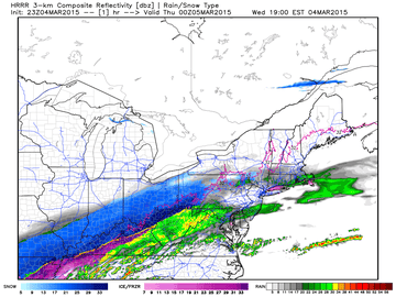
The storm could drop as much as 6 inches of snow in New York City as well.
Whitt said the storm should clear out by Thursday night, after which a high pressure system will lead to a dry but cold weekend.
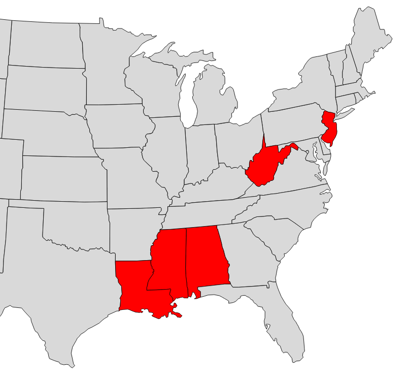
The approaching storm prompted governors to declare a state of emergency in New Jersey, Mississippi, West Virginia, Alabama, and Louisiana.
The storm had already dropped snow and rain across the Midwest and South on Wednesday.
In Tennessee, authorities issued a flood warning as the storm approached. In Oklahoma, drivers spent the afternoon and evening sliding on snowy roads.

2 VEH accident, I40 WB at Ft. Smith junction. Please take it slow in this area, heavy blowing snow @NEWS9 @OKI40thm
As the storm system moves north and east, it mixes with cold air coming down from Canada, Whitt said. The combination of the two patterns is what will produce the heavy snowfall on the coast, though Whitt added that it would have been more intense if the storm was moving up from the Gulf of Mexico.