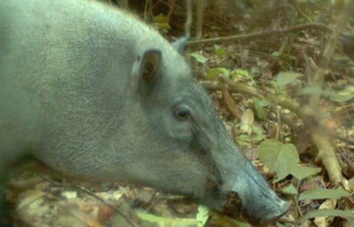
Determining whether or not a certain species are at risk of becoming endangered, requires years of vigilant monitoring of the species by scientists. However, thanks to the power of big data, the process is expedited dramatically, by applying big data analytics to rainforests and other habitats. As a result of such analyses, Conservation International found that species which were not considered to be at risk, are experiencing sizeable population decreases. In fact, it was determined that populations were dropping by about 30% among armadillos, anteaters, wild boars, civets, moon rats and shrews
How it All Works
The Vertica Platform, designed by HP, was designed to provide early warning signs amongst animal numbers who are at risk of extinction. The system collects data from thousands of cameras and climate sensors and uses the data to collate information on population numbers. This information is then fed into the big data platform, which allows for fast and accurate readings that help target specific species or areas
Obstacles and Solutions
The major obstacle that researchers were facing was not that this information was impossible to obtain, but, due to the large quantity of images, it was almost impossible to manage. Researchers would spend weeks, sometimes even months analyzing the data, making collations and then drawing conclusions. However, time is luxury they do not always have. Due to the time sensitive nature of the work, if the endangered population is found too late, it could mean the end for this species.
Thanks to the big data platform provided by HP, processing speed has almost doubled, thus providing an effective early warning system and, by doing so, freed up a lot of time for the personnel to actual make a difference and act on the data received.
The effect of Big Data on the Environment
Since the project began in early 2014, the system has more than 1.4 million photos from the monitoring cameras and has created more 3 terabytes of analyzable data. Plus, it also measures the habitat as well, allowing scientists to determine the cause of population decreases. The fact that the system can pick up even the smallest changes within the environment, means that scientists can account for this change and mitigate the impact in the future.
Thanks to Big Data, conservation research is much better which, in turn, protects endangered species. Researchers are using supercomputers and biotelemetry, to create 3D models of the terrain and the movement of endangered species. These technologies are being used today by the US Geological service in tandem with the Institute for Conservation Research at the San Diego Zoo. They developed a new methodology which uses advanced 3D technologies to provide data on the movements of wildlife species. Zmore details on their finding and methodologies can be found here.
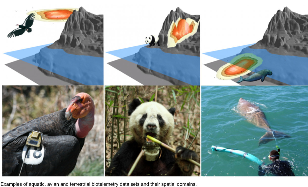
Even though 3D modelling is more expensive than traditional 2D, researchers were able to make faster calculations, what used to take four days, was accomplished in less that 30 minutes, and they were able to write the data in a more compact form enabling rapid input and output. A key goal of the project was to allow experts to remotely visualize the data stored within the supercomputer since it was of critical importance to minimize data flow and replication, especially when data volumes begin to grow
Future Goals
The next goal of the project would be to combine the data from all the data sources to get a clearer understanding of animal habitats. Ecology is entering the age of big data which means that cutting edge analytical and visualization tools are vital to process, manage and analyze ever growing volumes of accurate biotelemetry datasets. Otherwise, a deeper and clearer picture of the entire animal ecosystem will not be possible to determine
Share This Article