

Fitness tracker apps have exploded in popularity since the rise of motion sensors like Apple's M7 chip. Basically, a new phone bought today can tell if you are walking or running, and if you drove to your destination in a car or hopped on a bike. It can tell you how many steps you've taken and in which direction you went, with far more accuracy than any pedometer you can buy. They're getting more accurate by the day and, thanks to apps like Human, we can now use the anonymized data to illustrate the intricate and unique transportation patterns of each living city.
According to the company:
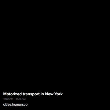
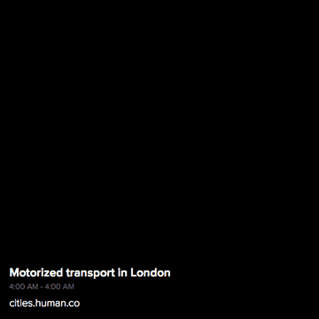
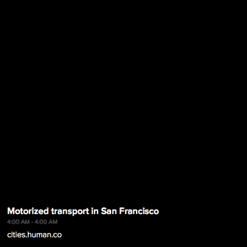
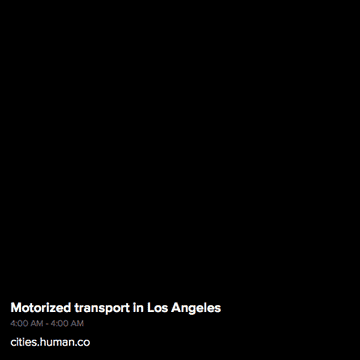
All visualizations and charts are solely based on aggregated data from people using the Human app. Imagery shown does not involve the use of maps, as white pixels were drawn by moving Humans.
Motorized transit in New York (as well as most cities) draws a near perfect map of the city:

San Francisco walking data reveals almost all the city's grid patterned streets:

...while Bangkok's walking data is very centralized...
...compared to its motorized transport.
Amsterdam, a city well known for its bicycle culture, has rather modest cycling traffic...
...compared to the much larger city of London, that is.
However, according to the data, Amsterdam residents spend a far higher percentage of their time riding.
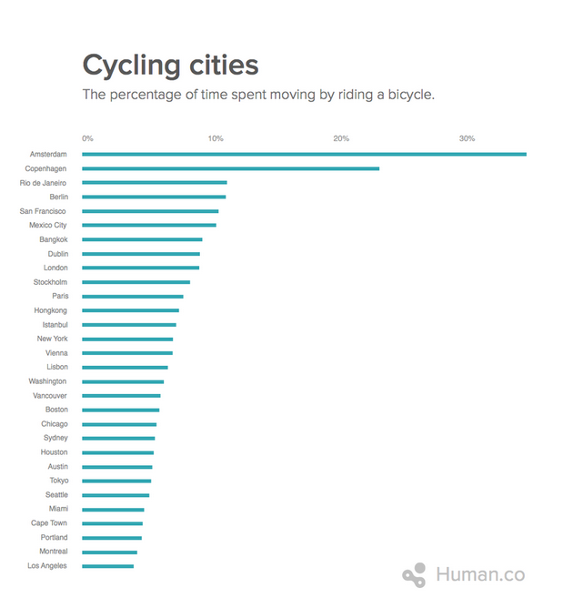
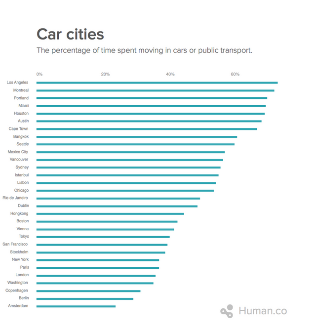
All in all, the most active large city according to Human data is Amsterdam, with LA coming in last...
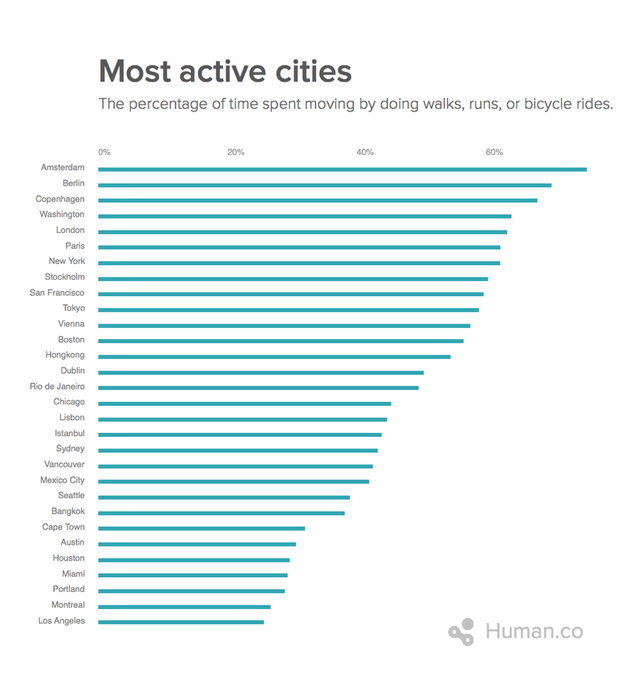
...probably because everyone is traveling around by car.
I mean...just look...
...not even CLOSE.
Check out more of the data at Human's site, here.