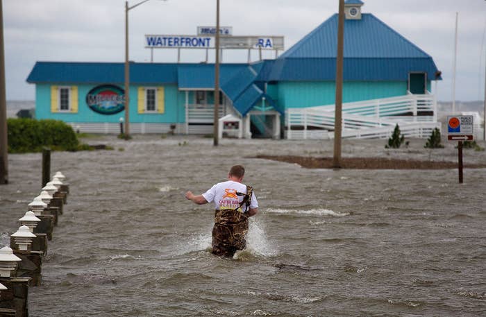
Hurricane Arthur weakened to Category 1 storm after bringing flooding and power outages to North Carolina's Outer Banks overnight.
Here are the current watches and warnings from the National Hurricane Center, which are in effect as of Friday at 11 p.m. ET.
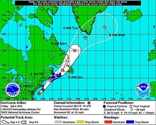
Current projected path of Arthur, including current watches and warnings from the NOAA National Hurricane Center.
Updates
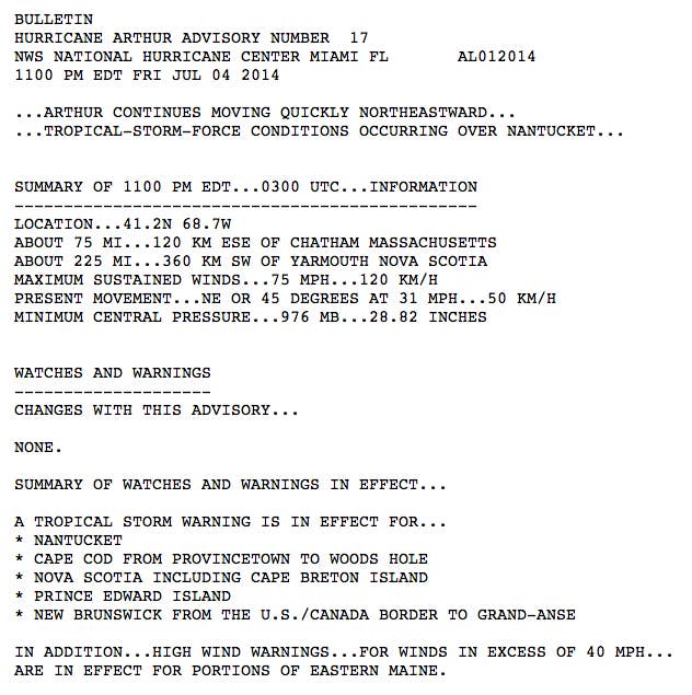
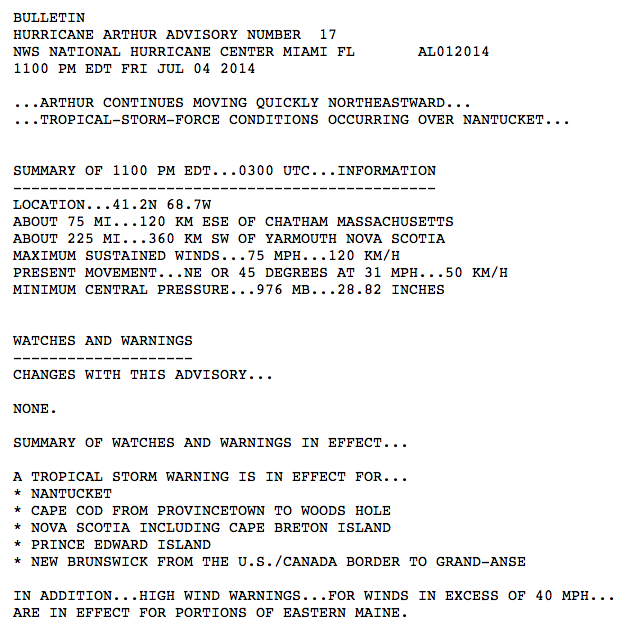
Winds continued to slow Friday night, and by 10:45 p.m. ET were maxing out at 75 mph. The storm was still moving northeast and was about 225 miles from Yarmouth, Nova Scotia.
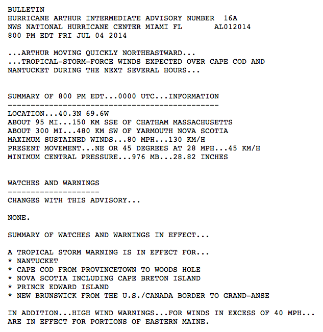
Arthur was moving northeast Friday evening with maximum sustained winds of 80 mph.
Arthur continued to drench New England.

Up to 6 inches of rain has fallen on eastern #MA today due to #Arthur,

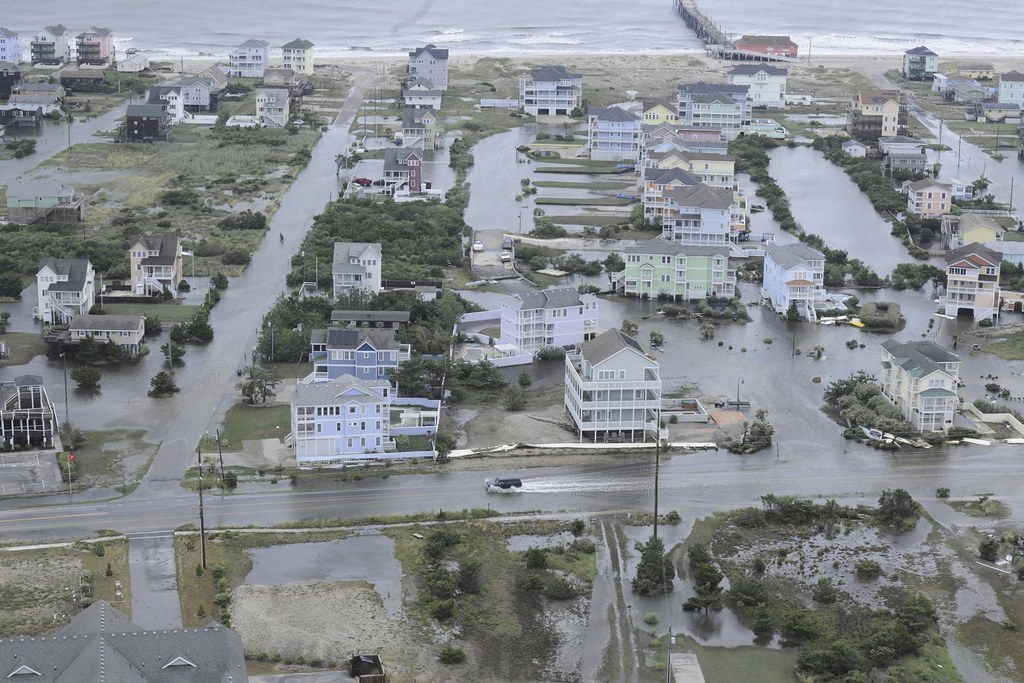
More shoreside flooding pictures from the #uscg helicopter of #HurricaneArthur damage.

#Hurricane #Arthur through a 10.5mm fish eye lens. Amazing to see nature at work.
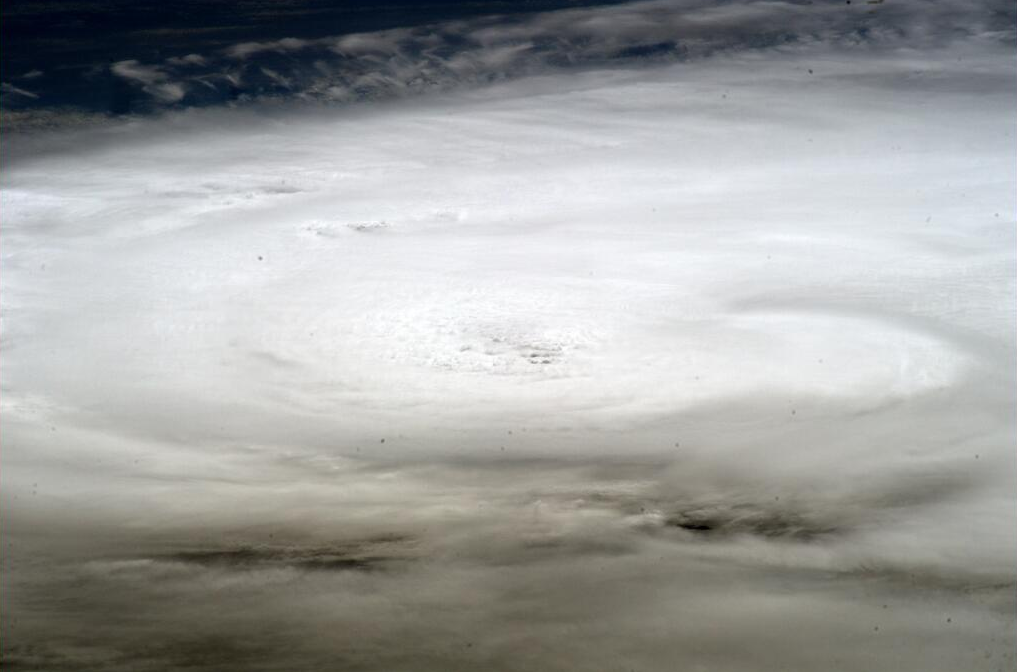
A view of the Category 1 storm from the International Space Station.
Hurricane Arthur's current projected path, via Weather Underground.
The center of the storm made landfall at 11:15 p.m. over Shackleford Banks, between Cape Lookout and Beaufort, North Carolina.
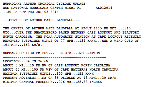

The eye of Hurricane Arthur now making landfall at Cape Lookout, North Carolina (10:54 pm ET)
According to the NWS, the eye of the storm was making landfall near Cape Lookout, in North Carolina, at 11 p.m. People in North Macon also noticed a dramatic drop in wind about 11 p.m., indicating they eye of the storm was moving over them, according to Weather Underground.
11:02 PM ET: Residents at Fort Macon note a dramatic drop in wind and is getting � quiet”. Clues they are in the eye of #Arthur

Gov. McCrory: 11 counties declared state of emergency; emergency response team ready to act in wake of #Arthur #ncwx
In a briefing Thursday evening, North Carolina Gov. Pat McCrory said a state of emergency had been declared in 11 counties. McCrory advised people to stay indoors and said emergency crews were standing by.
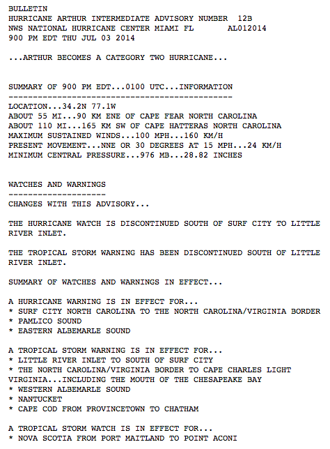
Arthur became a Category 2 hurricane Thursday evening, according to a NWS bulletin issued at 9 p.m. ET. Maximum sustained winds were hitting 100 mph and the storm was about 55 miles from Cape Fear.

All Dare County residents should be prepared for significant ocean overwash and soundside flooding from #Arthur #OBX
After Arthur began moving more west than previously expected, Dare County, in North Carolina, warned residents Thursday night that there could be significant flooding and overwash. The county established several refuges for anyone needing to escape the storm.
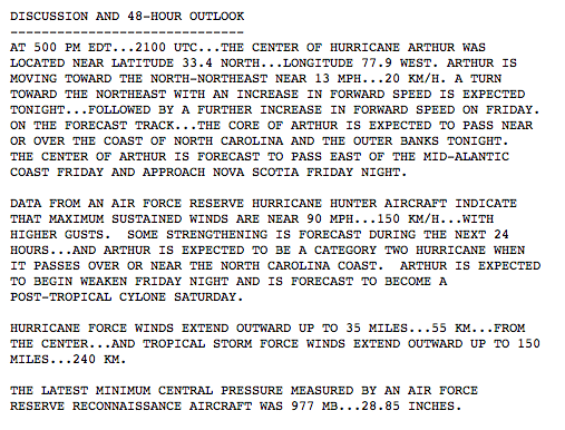
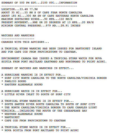
Arthur was moving north at about 15 mph early Thursday night with maximum sustained winds of about 90 mph. As of 7:30 p.m. ET, the eyewall — or the most powerful region of the storm — was just east of Cape Fear, in North Carolina.

NASA satellite imagery shows the progression of Hurricane Arthur on July 1st-3rd

Video taken earlier today from the Frying Pan Tower shows the very large ocean waves from Hurricane Arthur.


View this video on YouTube
The FPTower is a Coast Guard Light Station located 34 miles off the coast of North Carolina. Follow their Twitter account as it live-tweets the experiences in the tower during the hurricane.
Radar image shows the interaction between Hurricane Arthur and a cold front, which caused severe weather in many parts of the Northeast this week.

Obligatory satellite capture of #HurricaneArthur ...check out the interaction with the cold front!
New photo taken by Alexander Gerst aboard the International Space Station.

#ISS update on Hurricane #Arthur
Arthur is expected to become a Category 2 Hurricane by the time it passed over or near the Carolina coast.
Nantucket Island and Cape Cod have now been issued a Tropical Storm warning with the 5 p.m. ET update from the National Hurricane Center.
As of 2 p.m. ET, Arthur was moving north-northeast at 13 mph and is expected to increase speed tonight and Friday. The core of Hurricane Arthur is expected to approach the warning areas on the coast of North Carolina tonight.
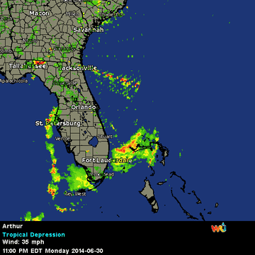
Radar shows Hurricane just off the coast of South Carolina.

Coastal radar shows entire inner structure of Hurricane #Arthur off S.C. coast now.
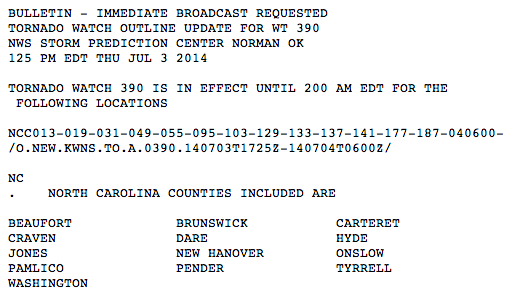
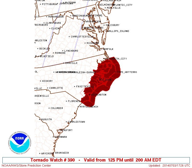
A hurricane-caused tornado watch is in effect for the following North Carolina counties until 2 am ET on Friday.
Hurricane Arthur's eye seen by Alexander Gerst from the International Space Station.
Arthur strengthens as it heads toward land.

Arthur now expected to be a Category 2 hurricane while it it moves near or over eastern North Carolina tonight and early tomorrow.

PLEASE RT: 11am NHC Advisory on #Arthur has increased the max winds and shifted the track slightly west. #ncwx #obxwx
Most of North Carolina's coast was given a hurricane warning, plus a mandatory evacuation of Outer Banks' Hatteras Island.
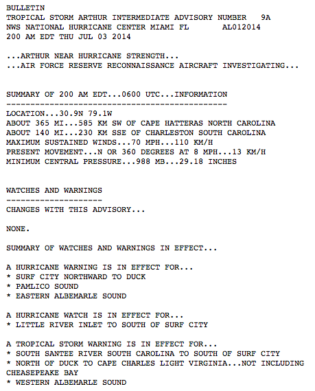
Arthur was nearing hurricane strength early Thursday morning but remained a tropical storm. It was 140 miles from Charleston. The National Weather Service reports that the U.S. Air Force deployed an airplane Thursday to investigate the storm.
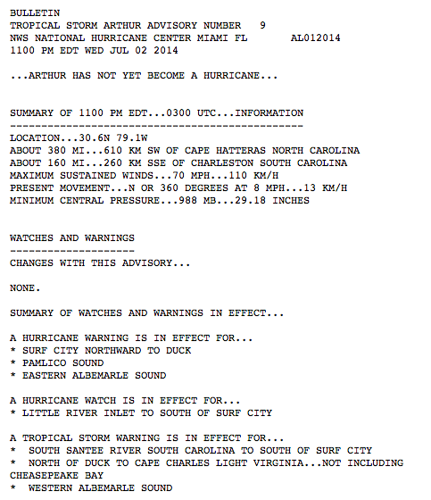
Arthur was about 160 miles south, southeast of Charleston, S.C., at 11 p.m. ET Wednesday. It had not yet become a hurricane and continued moving north at 8 mph.
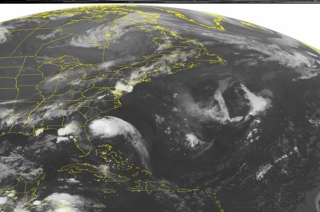
Satellite imagery from the National Weather Service shows Tropical Storm Arthur off the east coast of Florida on July 2.
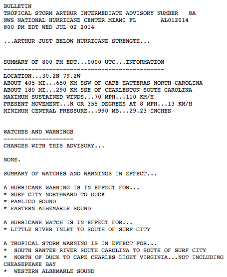
Arthur is currently moving North at 8 mph, with maximum sustained winds remaining at 70 mph.
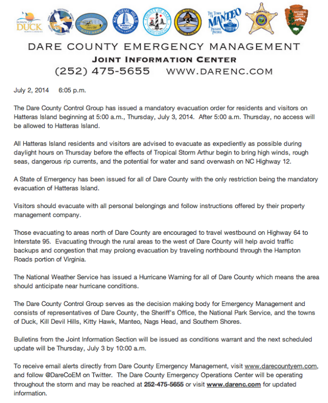
Mandatory evacuations have been ordered by Dare County Emergency Management for residents and visitors on Hatteras Island in the Outer Banks of North Carolina.
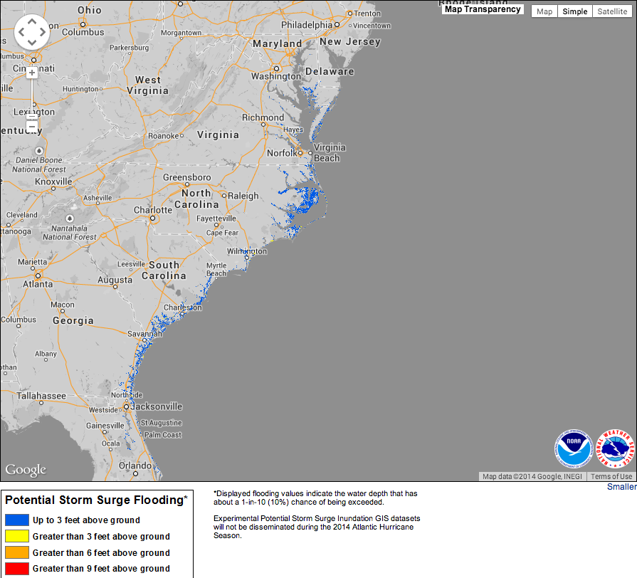
A map from the National Hurricane Center shows the areas that could be impacted by flooding from storm surge.